Hardware
|
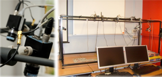
Multi-camera system
Set of 6 cameras hardware-synchronised connected to 2 computers for image grabbing. |
|
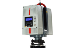
Leica HDS6200 Terrestrial Laser Scanner
The HDS6200 is a portable, phase based laser scanner. With a range of approximately 80m the TLS can acquire data at a rate upwards of a million points per second. Initial processing can be undertaken in Leica’s Cyclone software with data able to be exported for a range of other software including ArcGIS and AutoCAD. Built in WLAN allows for operation through a phone, tablet or laptop. |
|
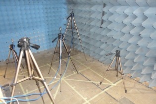
Anechoic chamber
Ultra wideband localisation is performed in different environments for testing its precision and accuracy. The anechoic chamber is one of the environments where these tests are made. |
|
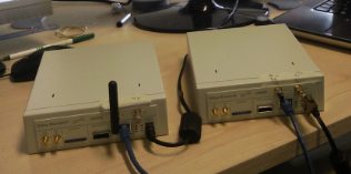
Universal Software Radio Peripheral (USRP)
USRP N200 and Radio Frequency data board XCVR245 designed by Ettus Research to sense the frequency spectrum from 2.4-2.5 GHz and from 4.9-5.9 GHz. |
|
Sensors and Software pulseEkko PRO Ground Penetrating Radar
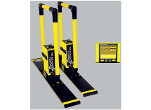
The pulseEKKO PRO GPR system allows for imaging of the subsurface across a variety of bandwidths. The three antennas that we have available are 50MHz, 100MHz and 200MHz. The fully bistatic design allows for advanced survey types such transillumination and multi-polarization. As well as the handles there is a SmartCart which the system can be mounted allowing for rapid data collection. |

|
Nao robot
Nao Robot is a programmable and autonomous humanoid robot produced by Aldebaran Robotics. |
|
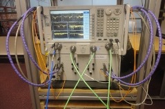
Agilent 4 Port PNA-X for high accuracy localisation using ultra wideband localisation
Ultra wideband localisation can carry signals through many obstacles that usually reflect signals when the bandwidth is limited. Agilent 4 Port PNA-X is used for the sensing at higher power that makes indoor ranging and localisation more accurate. |
|
Topcon IS 203 Imaging Station
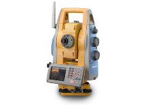
The Topcon IS 203 is a scanning, robotic, reflectorless imaging station which allows for high, mm level, precision 3D measurements. It combines advanced imaging and high-accuracy surveying, incorporating real-time field imagery with spatial data. The auto tracking feature makes this ideal for one man surveys. |
|
|
Audio system
Set of 4 VisioBoxes for audio recording with two or three stereo microphones. |
|
Leica RTK GNSS
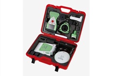
Combing the Viva GNSS GS10 base station and GS14 rover the Leica RTK allows for data collection at centimetre accuracy. The system works across the GPS and/or GLONASS satellite constellations. The system is designed to be used in harsh environments and is rated against dust, water and temperatures between -40°C - +65°C. |

|
Bumblebee transponder
A harmonic radar is used to track bees' flight paths. |
|
Textile machinery
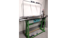
Electronic textiles can be constructed using our semi-industrial digital embroidery machine, sewing machine, flatbed industrial knitting machine, and 16 shaft table loom. |